Visualisierung der Verzerrungen von Kartenprojektionen als interaktive Rauminstallation
Visualization of map projection distortions as an interactive spatial installation
Die interaktive Rauminstallation setzt ein Statement gegen das eurozentrische Weltbild, indem sie
Verzerrungen von Kartenprojektionen visualisiert. Das Hauptziel des Projekts besteht darin, ein
tieferes Verständnis für Kartenprojektionen zu vermitteln und kritische Fragen zur Objektivität und
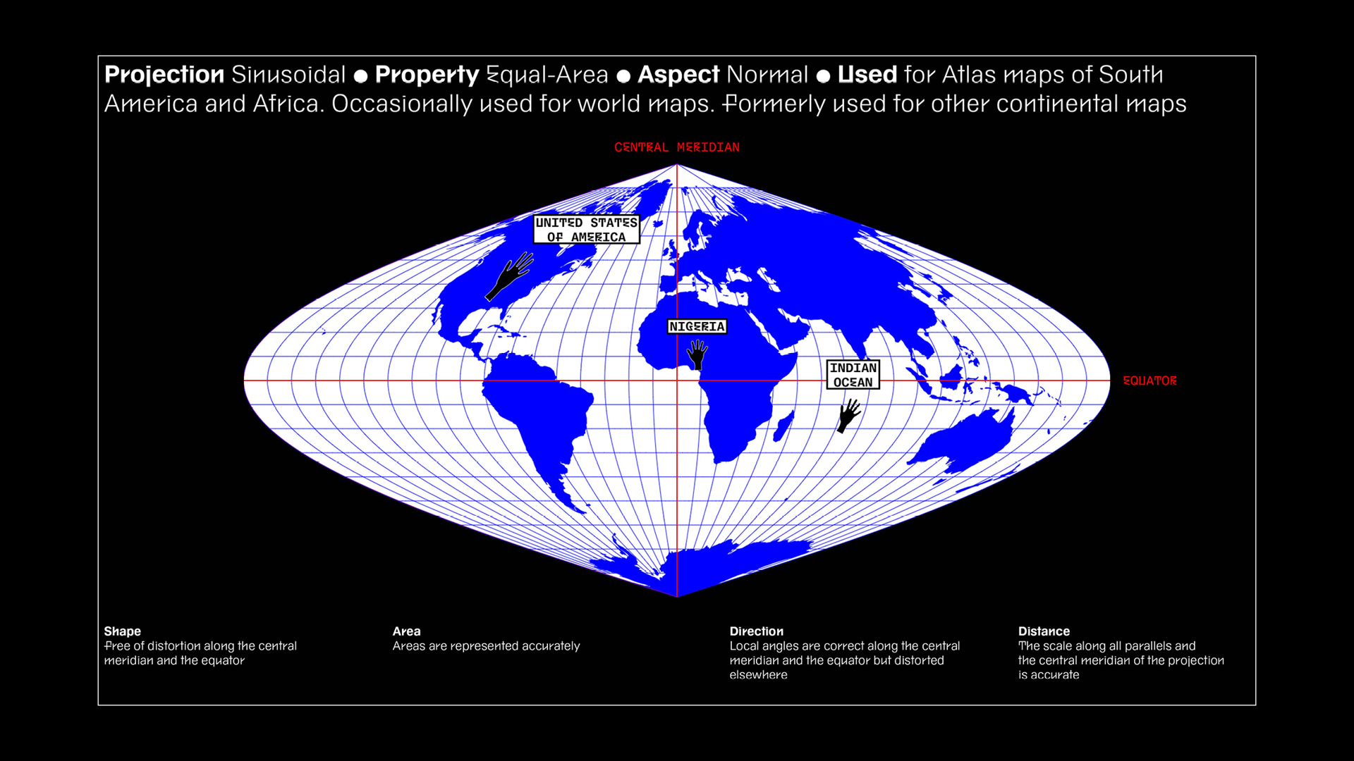
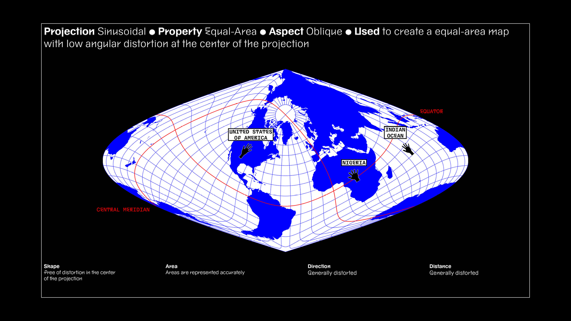
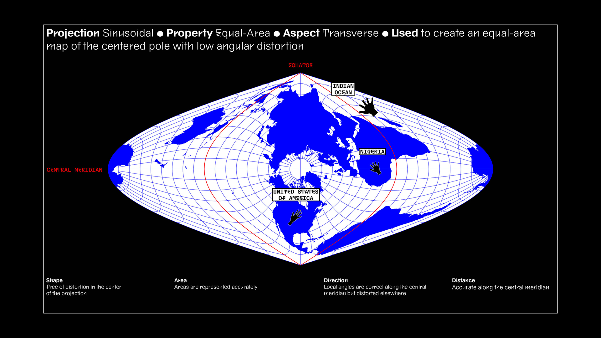
Repräsentation in der Kartographie aufzuwerfen. Die Installation zeigt simultan drei Projektionen,
von denen jede eine der metrischen Eigenschaften von Kartennetzentwürfen repräsentiert: winkel-,
flächen- und längentreu. Durch den Verzicht auf eine Nord-Süd- bzw. West-Ost-Perspektive findet die
konstante Rotation der Erde um ihre eigene Achse ebenfalls Berücksichtigung in der zweidimensionalen
Kartendarstellung.
Die Erdkugel, die sich zentral im Raum befindet, fungiert als objektiver Vergleichspunkt zu den
Weltkarten. Den Besuchern bietet sich die Möglichkeit, ihre Hand auf alle Karten gleichzeitig zu
projizieren und so die Verzerrungen auf empirische Weise wahrzunehmen. Auf diese Weise sollen sie
dazu ermutigt werden, eine kritische Reflexion über die bestehenden Machtstrukturen und Vorurteile
in der Kartographie vorzunehmen.
Die Visualisierung der Kartenprojektionen erfolgt unter Verwendung von Mike Bostocks Code
»Projection Transitions«.
This interactive spatial installation makes a statement against the Eurocentric worldview by
visualizing the distortions of map projections. The primary goal of the project is to provide a
deeper understanding of map projections and to raise critical questions regarding objectivity and
representation in cartography. The installation simultaneously displays three projections, each
representing one of the metric properties of map projections: conformal, equal-area, and
equidistant. By abandoning a fixed north–south or east–west orientation, the work also reflects the
Earth's continuous rotation on its own axis within a two-dimensional map representation.
A globe located in the center of the space serves as an objective point of comparison for the world
maps. Visitors have the opportunity to project their hand onto all maps simultaneously, allowing
them to perceive the distortions empirically. In doing so, they are encouraged to critically reflect
on existing power structures and biases in cartography.
The visualization of the map projections is realized using Mike Bostock’s »Projection Transitions«
Rauminstallation
UI/UX-Design
Informationsdesign
»Projection Transitions« – Mike Bostock
After Effects
Indesign
Spacial Installation
UI/UX Design
Information Design
»Projection Transitions«—Mike Bostock
After Effects
Indesign